
Kilmartin Glen and Knapdale Cultural & Natural Heritage: A Self-Guided Trail
If you are planning to visit the Mid Argyll area and wondered what ‘treasures’ there are to see in this beautiful landscape, look no further as we have a self-guided trail which will take you on a journey of discovery and you will visit some of the most interesting locations in Mid Argyll.
Please download the self - guided trail sheet by clicking on the button below.
Don’t forget to take photos of your adventure too – Just use #HAWO21 and share your photos on Instagram, Twitter or Facebook. Tag Kilmartin Museum or Heart of Argyll Wildlife Organisation too!
Archaeology Treasures

Site 1: Nether Largie Standing Stones
Directions: Situated 50m NW of the Lady Glassary car park 1-mile South of Kilmartin via the A816 on the B8025.
The Nether Largie Standing Stones were possibly built during the Middle Bronze age 3,000 years ago (1400 – 1050BC) and we do not know why they were built. Standing next to the central stone and looking North, you will see in the near distance the burial cairns which lead up to Kilmartin village. Looking to the South you will see the top of Bellanoch hill.
Some of the stones are decorated with cup mark carvings, some with rings around them.
Look at each stone and see if you can find cup marks on them – how many stones are decorated with carvings?
Why do you think people placed these stones here?
3d Model of the central Standing Stone:
Nether Largie standing stone, Kilmartin Glen - 3D model by Dr Aaron Watson (@aaronwatson) [cfcea2f] (sketchfab.com)

Site 2: Temple Wood Stone Circle
Directions: On foot from the Nether Largie Standing Stones continue NW across the field to the gate onto the minor road where you will find the Stone Circle.
Having left the Nether Largie Standing Stones you now ‘travel’ back in time to visit Temple Wood.
At Temple Wood there are actually two circles to visit. The first circle to the North (Temple Wood North Circle) is the smaller of the two and construction began around 5,000 years ago and was originally made out of timber, with stone being added later to replace the timber posts. Some archaeologists believe that this timber circle was used for ceremonies or as a meeting place. The timber posts and the later stones are no longer in place apart from the stone setting in the centre, but you will find round and rectangular concrete markers identifying the places where the posts and stones were once placed.
How many round markers which show the position of the original wooden posts can you find?
How many rectangular markers which show the position of the original stones can you find?
The second larger circle (Temple Wood South Circle) was built using stone and was believed to have been used originally for ceremonial purposes and then modified over the next two thousand years including the addition of horizontal stones, a cairn which largely buried the standing stones; and cists in and around the circle.
Two of the stones in the South Circle have designs pecked onto their surfaces, which are still faintly visible.
Caution required on site as stones can become slippery when wet.
Can/did you find the stone with the carved spiral?
How many standing stones are there in the circle?
3D model of Temple Wood Stone circle:
Kilmartin - Temple Wood - A 3D model collection by Dr Aaron Watson (@aaronwatson) - Sketchfab

Site 3: Nether Largie South Cairn
Directions: On foot from Temple Wood Stone circle walk NE (towards Kilmartin) along the road for 100m, the Cairn is on your right just before you reach Nether Largie Farm.
This is one of the oldest monuments in the glen built over 5,000 years ago (3700-3600BC) and originally it would have looked quite different to what you see before you today. It was a place for burial for many generations and its chamber was originally designed so that the living could also enter.
A chamber nearly 6 metres long was built, divided into 4 segments by large slabs and interspersed with stretches of dry stone walling.
From the excavation that took place in 1864, a Neolithic pottery vessel was found dated to 3600-3500 BC. In the Bronze Age, a small cist (stone coffin) was built inside the chamber and this contained a Beaker pot. Cremated human remains and sherds of another Beaker pot (2300 BC and 2000 BC) along with barbed and tanged flint arrowheads and smashed quartz pebbles were also found in the chamber. Eventually, the chambered cairn was closed, the surrounding cairn extended, and a cist placed to the south-west of the cairn which you can also see today.
Can you imagine how many people it must have taken to build this Cairn?
Caution required on site as stones can become slippery when wet.
Kilmartin Glen: Nether Largie South Cairn | Hist Env Scotland (historicenvironment.scot)
Site 4: Moine Mhòr NNR Tileworks trail
Directions: From the Lady Glassary car park travel South on the B8025 for approx. 1 mile. The trail starts at the car park for the Nature Reserve situated on your left.
The Moine Mhòr (Great Moss) was formed around 5,000 years ago and would have been an area familiar to the early farmers of Kilmartin Glen.
The Moine Mhòr is an area of great natural beauty comprising of expanses of peat bog and unique plant life that is a perfect natural habitat for insects, birds and animals including dragonflies, the Marsh Fritillary butterfly and the Hen Harrier.
The Tile Works Trail is so called because, many, many years ago, clay was removed from the area and used to make the drainage pipes that helped to drain areas of the peat bog. Follow the short trail through the Oak and Birch woodland and enjoy the panoramic views of the great moss when you reach the wooden viewing platform at the far end of the wooden boardwalk.
A really good view of the Moine Mhòr can be taken from Bellanoch Hill and also from the summit of Dunadd.
Look out for the tiles beneath your feet!
Did you see any dragonflies and if so, what colour were they?
Did you see any butterflies and if so, what colour were they?
NatureScot Tileworks Trail information available to download here:
Moine Mhor National Nature Reserve Tileworks Trail Slighe Nan Leac | NatureScot
Dragonflies - British Dragonfly Society (british-dragonflies.org.uk)

Site 5: Dunadd
Directions: from the Tileworks car park continue south on the B8025 for approx. 1 mile and take the first turning left at the T-junction with the A816 turn right. After approx. ¼ mile take the first right sign posted for Dunadd Fort.
Overlooking the River Add, the rocky hill of Dunadd rises up from the Moine Mhòr. Fundamental in the story of the making of the Scottish nation, Dunadd is an archaeological site of great importance. First fortified approximately 2,400 years ago, Dunadd was later chosen as the seat of the Kings of Dál Riata about 600AD and is believed to have been the capital of this ancient kingdom. The first kings are said to have been inaugurated (crowned) at Dunadd and it is thought that they placed their foot within the carved footprint which can be found on a terrace below the hill top.
Can you also see anything else engraved on the flat stone by the footprint?
Kilmartin Glen: Dunadd Fort | Historic Environment Scotland | HES
3D model view of Dunadd:
Sketchfab - The best 3D viewer on the web

Site 6: Achnabreac Forest Park – Ancient Rock Art
Directions: From Dunadd return to the main road (A816) and turn right in the direction of Lochgilphead. After approx 2 miles you will see a sign to Cairnbaan (B841), opposite this junction turn left along the forest road for approx. ½ mile to the car park at Achnabreac.
One of the finest prehistoric rock art sites in Scotland, and the largest of its kind in Europe.
On arriving at Achnabreac Forest Park, there is a large trail map in the car park. Visitors can follow the designated forestry path to the rock art site.
The Achnabreac carvings are believed to be around 5,000 years old and there are two main outcrops that can be visited. Many varied motifs can be seen carved into the rock panels including cup marks, and cups with multiple rings.
Why do you think the carvings were made?
What do you think the symbols mean?
Who carved them?
How were they carved?
Achnabreac - Forestry and Land Scotland
3D model of the West panel
Sketchfab - The best 3D viewer on the web
Natural Treasures
Site 1: Bellanoch Bird Hide
Directions: From Lochgilphead take the A816 Oban road for approx. 2 miles. Turn left for Cairnaan onto the B841. Follow the canal along this road from approx. 3 miles to Bellanoch. Thurn right onto the B8025 (signed Oban). You can park along side the road beyond the bridge (please do not park in the signed turning area). On foot return to the canal tow path and turn right heading to Crinan. The bird hid is on the right approx. 300m along the canal.
From the hide you can watch the ever-changing cast of animals from ospreys to otters. The salt marsh and estuary provide vital feeding grounds for wetland birds all year round. Ospreys can be seen fishing for sea trout and you might be lucky to see a massive white-tailed sea eagle. Oystercatchers, wigeon, teal, dabchick, herons, shelduck, mergansers and many others can be spotted.
Which birds did you see?
What is the name of the river that runs into this estuary?

Site 2: Crinan Wood
Directions: you can either continue on food along the tow path for approx. 1.5 miles to the next bridge, cross the bridge and turn left up the minor road. After 100m you will see the footpath sign for Crinan Wood on your right.
Or, by car – cross the Canal bridge and turn right along the B841 to Crinan. The road turns sharply left up hill with a fork on the right. Turn right here and park on the left. Walk along this road until you see the footpath sign for Crinan Wood on your left.
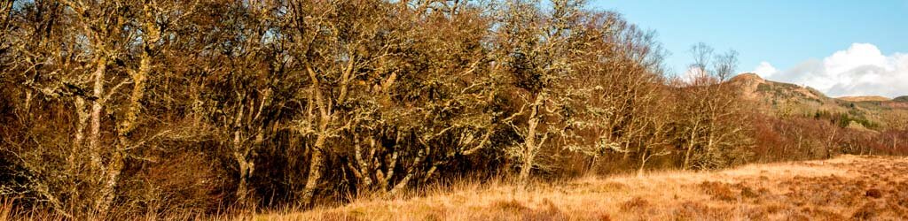
Managed by the Woodland Trust, Crinan Wood is an iconic example of Argyll’s Atlantic Rainforest with the added bonus of stunning views over loch Crinan and the Sound of Jura. Look out for red squirrels amongst the ancient oaks. A circular walk of 2.5 miles with some steep climbs on unpaved and often muddy path.
What is the most famous type of tree in the Atlantic Rainforest?
Can you name a lichen that can be found in the woodlands that shares its name with a body part?

Site 3: Viewpoint
Directions: From Crinan drive along the B841 towards Lochgilphead after 1 mile turn right on the B8025 (signed Tayvallich). After approx. 1 mile follow the Green Forestry and Land Scotland sign to the Barnlusgan car park on the left at the fork in the road. On foot, follow the footpath sign to the view point and wildlife centre.
You are looking back up Kilmartin Glen and 8,000 years of human and natural history. Below you, the 220-year-old Crinan Canal, another of Thomas Telford’s masterpieces. In the distance you can see Dunadd, and Duntrune Castle, the 13th Century seat of power of the MacDougal’s, now owned by the Malcolms of Poltalloch.
Stretching north of the canal is Moine Mhor (The Great Moss) National Nature Reserve. This raised bog is the home to many unique and endangered species, marsh fritillary butterflies, spectacular dragonflies and the sphagnum mosses that hold phenomenal amounts of water. The bog began its life over 5,000 years ago and is older than the archaeological sites that surround it.
Turn to the west and you can see the Hebridean islands of Scarba (Norse for cormorant island), Luing, Norse also, meaning ‘heather’ (and easy to spot due to its wind turbine), with the mountains of Mull to the north.
Can you name one of the rare birds of prey you might see flying over Moine Mhor?
What animal is carved above the door of the wooden compost toilet building at the wildlife centre?

Site 4: Barnluasgan/Oakwood Trail
Directions: From the view point retrace your steps back down the hill taking the left hand turn back towards loch Barnluasgan. Turn left walking clockwise around the loch (the opposite side to way you came up). Turn left at the green trail marker sign up the steep hill onto the Oakwood trail. The trail is just over 1-mile-long which includes a steep ascent and decent back to the trail around loch Barnluasgan. Turn left back to the car park.
Immerse yourself in the Atlantic Rainforest that has stood here for over 7,000 years! It’s easy to do, we enjoy 2 meters of rain per year; compare that to Edinburgh’s measly 750mm! Mosses, ferns, liverworts and lichens thrive here, with over 200 species of lichens alone. The hazel stands you walk through on the way up the trail are very old and have some very strange species that find their home amongst them, such as glue fungus and hazel gloves. As you climb higher you are surrounded by Knapdale ancient oak woods with excellent views over Knapdale’s woods and lochs.
Can you name the famously reintroduced animal lives in the Knpadale lochs?
Can you name two tree species that you can find on this trail?
Site 5: Carsaig Bay
Directions: turn right out of the Barnluasgan car park and immediately left onto the B8025 to Tayvallich. Continue for 5 miles. On entering the village pass the pub on the right and take the next right turn signed to Carsaig. The road continues for ½ mile and ends at parking at Carsaig bay.
A gently shelving bay with a mixture of sand and rock with areas of shallow water at low tide. The shallow waters are ideal for seeing some of the underwater life that dwels in this fascinating diverse environment between the tides. Alternatively, just enjoy the uninterrupted views towards Jura, take a wander around the bay and return via Tayvallich for food and drink at the inn or café.
What animal is called a fish, but is not a fish, and sounds like it’s twinkling in the night sky?
What is the body of water called that lies between the bay and the island of Jura?

Site 6: Taynish National Nature Reserve
Directions: Return to Tayvallich. At the T-junction turn right continuing through the village. After the village hall on the left and toilets on the right take the left hand fork signed for the Nature Reserve. Follow this road for approx. 1 mile to the car park.
The woodland dates back 7,000 years. A wide range of insect life, butterflies, moths and dragonflies thrive here; 13 species of dragonfly have been recorded. You also have a good chance of seeing one of the reserve’s other star attractions, the otter, there is a viewing hide at the southern end of the reserve. Many more people lived in Taynish than do now. The large mill is a testament to the food produced here. During the summer you will find lots of things to do here – an art exhibition in the reserve featuring various local artists work hidden around the woodland tracks. There is also a new Pollinator nature trail along the path to the mill which is suitable for all the family.
How long was the Mill in operation?
Can you name the rare butterfly that can be found on the reserve?
Nature Scot Reserve Information